Hiking at Bukit Wawasan (Puchong, Selangor)
Weekend Hiking at Bukit Wawasan (Wawasan Hill)
Wawasan Hill (Bukit Wawasan) is a relatively small hill situated in Puchong Bandar Puteri residential area and has an average height of 233 meters and loop distance of just under 2km.
What's interesting here.
- This trail is fairly short with small elevation here and there. Hence, if you just want to get a feel of hiking and sound of forest insects, this gentle trail will be the place for you.
- Don't rush it - just take time to stop, view the vegetation and enjoy the cooling weather in the hill.
- Just before the end of the trail, do take a small pause... there's a small little creek (pond), where you can see lots of tortoises.
Let's start to explore the trail.
After you get yourself settled down and car securely parked, walk 5 minutes toward the main entrance, which is just beside some small food stall. When you arrived at the main trailhead, you will see a big green signboard which indicate the point of entrance.
Entrance/Exit - starting point of the trailhead.
Just follow the trail and after walking passed the signboard for few minutes, you will come across a small steel ladder.
At the start of the trailhead - happy hikers climbing up the small steel ladder.
The beginning of the trail is quite gentle and hence you can probably use the first 20minutes as a quick and easy warm-up session for your legs. Hahaha!
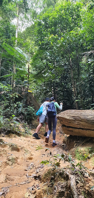
Hiking ascending the small slope leading to the peak of the hill.
Trail leading toward the wooden bridge area.
Toward midpoint of the trail, you will hike downhill with a small stream. You need to go across the wooden bridge and continue upward.
At the end of the trail (just before you exit back to car park area), you will come across a small stream with its lively inhabitant (ie. catfish and lots of tortoises)
Once you passed this pond, the hike is officially completed, and you will return back to the car park area where you started. You can get light refreshments and snacks from the small vendor here.
Trail distance/duration
- This is a fairly short trail (2km) and a roundtrip will take about (1.5hours)
- Is a very easy trail to hike - trails is not overly steep hence is very easy to maneuver.
Getting here
- As this is quite a well-known hiking place, your Waze/Google map app will be able to lead you all the way to the trailhead.
Where to park your car
- As it located adjacent to residential area, parking space is very limited and likely you have to park your car beside along the road from the residential flat and surrounding areas near the shop lot.
- Note: As it a residential area, unlikely police will issue summon on roadside parking.
What to prepare
- A bottle of water for hydration (and probably some snacks to replenish your sugar/salt level)
- Pair of comfortable hiking boot
- Trekking pole
.jpg)


Comments
Post a Comment